
Not that it doesn’t connect, it does. Sort of. You see, I thought it connected to the Mt. Balckmoor TRAIL at the LAKE. As we hiked along, it became apparent that I was wrong about this… and thus begins the story of an 11 mile hike that turned into a 22 mile epic…
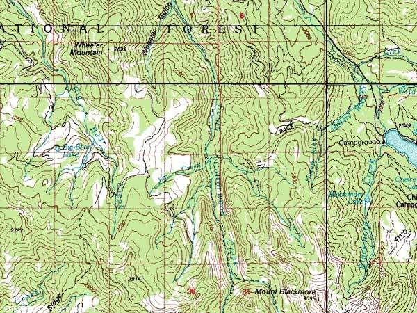
Okay. Here is the map. Look in the middle to find Cottonwood Creek, the trail runs along side it. Now go to the bottom, you’ll see the trail split around Mt. Blackmoor. Now look at the right, the body of water? That’s Hyalite reservoir, where one of our cars is parked. The other one is off the map at the S. Cottonwood Canyon trail head, where there is a sign that says, “Mt. Blackmoor, 11 miles”. (Not the Lake, Kate, the MOUNTAIN.) Well, (sigh) they don’t call me SuperKate for nothing.
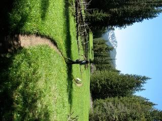
It started out so great, the weather was amazing, we left to shuttle the cars at 7:15, thinking we’d hike from S. Cottonwood to Blackmoor lake, and connect to the trail that goes over to the resivoir, and be done at like 12:30 or so. I told Tom we’d be home for lunch.
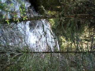
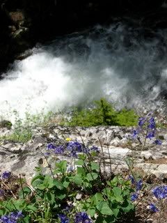
Yes, I opened my book and recorded flower after flower that I’d never seen before, including a really rare wild orchid, some wild irisis… it was truly amazing.
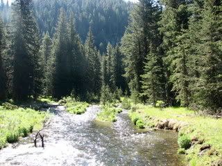
The recent storms had wreaked havock, and some massive trees had fallen across the trail, bringing lots of little ones with them, and creating a bit of a pokey obstacle course. But no matter! Nothing is a match for SuperKate!
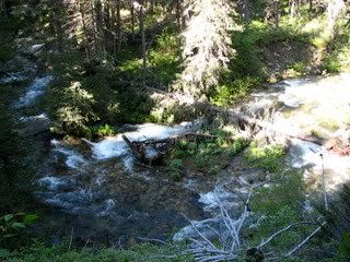
But she tried. More than once. Luckily, she managed to get into an eddy and swim back to shore this time. I coaxed her out on the bridge. She wouldn’t go without me. I didn’t want to be ahead of her. But… she finally followed me out, and we walked across, and she got closer, and closer, and then she FREAKED OUT and tried to get between my legs to get to the other side. Thanks, Wya!
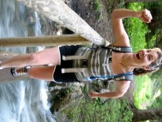
So, this is me wringing my shorts out after I fell off the bridge face down in the whitewater… and now I am sporting some rather awesome purple bruisage on my hand, thigh, knee, and shin from SMACKING it into the river bottom.
Lucky me, my savvy sister (who had to listen to me regurgitate my newfound Whitewater Rescue and Safety knowledge all the freakin’ way up the trail thus far…) was standing right on the bank with her hand out, and the second I realized that I couldn’t breathe because I wasn’t standing on the bridge anymore, but I was face down in that Really Freakin’ Cold Water, and I flipped over, her hand was there and she pulled me out. Thanks, Liat!
But I was beginning to worry. It was about noon, and we hadn’t even made the lake yet. I knew we were past it, and probably heading to the Mountain itself. Now, I have skied Mt. Blackmoor, as you no doubt remember, the great “Follow the skin track there will only be one” episode. (And by the way, (regarding that post...) its not a 16 mile trip, I think its actually an 8 mile trip. But whatever...)
So I was aware of the fact that if this trail was taking us up the backside of Mt. Blackmoor, we were going to summit, and then, I don’t know, glissade down?? And then catch the 4 or so mile trail out to the car. So… okay, total of 15 miles instead of 11. We could handle that, we hike fast, and we’d only be an hour and a half late.
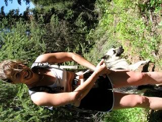
I told Liat at this point that it was going to be longer than we thought, and she had pretty much figured, and we sort of chatted less (because the trail was a lot harder to find) and hiked on, picking up speed. You’ll notice that there aren’t any more pictures after this. Hmmm…
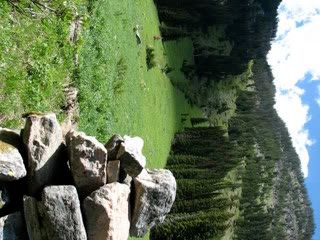
So the trail was like a faint line in the meadow, and we followed it from giant cairn to giant cairn… there is a huge meadow where there are three of them to mark the way, and that was really amazing, and it made me feel good to know we were on the right path, and not just on an elk path… (we had passed a HUGE skeleton earlier, just amazing, the vertebrae were like 7 inches across… sorry I didn’t take a picture…)
Anyhow, my concern was becoming that I wasn’t sure if this trail was just going to take us out into the wilderness, deeper and deeper, sort of end up out in Yellowstone somewhere, benighted with no food or jackets… uh…
I asked Liat the horrible question… what time is it? At this point, it’s 1:30 in the afternoon. It was supposed to be thundering by 1, we were supposed to be HOME by 12:30… and we are 5 ½ hours out and lost.
I was SO tempted just to scrabble over what I assumed was Mt. Blackmoor on our left, and scramble down and find the trail and get to the car… but you know, this is how you end up in the newspaper.
We could look for the trail… but it was already turn around time. I didn’t have a headlamp or supplies to get benighted, (although, yes, we had a water filter, first aid, matches and all that, just no blanket, uh… MAP, or jacket… plenty of food, though…)
So we decided. Time to turn around, and hike the (at least) 11 miles we had just done in reverse. We’d be out at 7:30. We’d be 7 hours late. Tom would be insane, the sheriff would be on his way… oh, man.
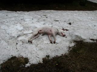
And then Liat had an inspired idea. We could run. It’s faster. So we sinched down our packs, and ran out. On the way out, Wya decided she’d had enough of this river crossing on a log nonsense and decided to swim it again.
She got swept in the current, pinned against a strainer, and her head went under. This is a 90 pound dog! I was standing there, looking at her, knowing I couldn’t save her, when the branch she was pinned on broke, and her butt swung downstream, allowing her head to come up, and she swam for her life into the eddy.
She came out of the water into my arms, and just stood there, staring at me. She didn’t shake off, or move, she just looked at me. Then I told her to hop up on the log, and she did, running across it at light speed, and falling off on the other side into the water again. She swam out on that side.
We had six bridge crossings to go. Each one, she ran, slamming into the supports on the ones with railings, nearly falling in on every one. She made it.
We all made it. We got home at 5:20, and it was so bizarre to see Tom mowing the lawn, slightly cranky that we were late, the kids playing on their bikes… life had been so dire only 4 hours before…
Anyhow, this is my protracted excuse for not working out since Saturday, because well… today (Tuesday) is the first day I have been able to, you know… walk around and stuff. (Wya, the amazing trooper, has been laying almost in one place since Saturday… she’s up and around today.)
And thus endeth the epic. And yes, I have a topo now. Thanks for asking. And, by the way, now I REALLY want to do the Ridge Run! Too bad its full!! It's only 20 miles!
1 comment:
So I just got this email... which made me laugh out loud... so true...
Yup. I've been reading your blog. Anyway, if you will go to Northern Lights or some other place that carries USGS maps, you should purchase a "U.S. Department of Agriculture forest Service Northern Region Forest Visitor Map of the Gallatin National Forest" On it you will find that you missed a left hand turn to the trail that would have taken you past History Rock and out to Hylite Canyon Road about a third of a mile below the dam. It would have saved you one devil of a walk around the mountain. Oh well. Isn't life just full of little surprises.
THANKS!! Guess we'll do it again with the map...
Post a Comment